Streamlined information from aerial systems
Automate the processing and exploitation of drone data feeds for Public SafetyOnline mission support for handling drone data throughput
Processing Management Exploitation Operational Picture
What can I get out of UAS/drone data?
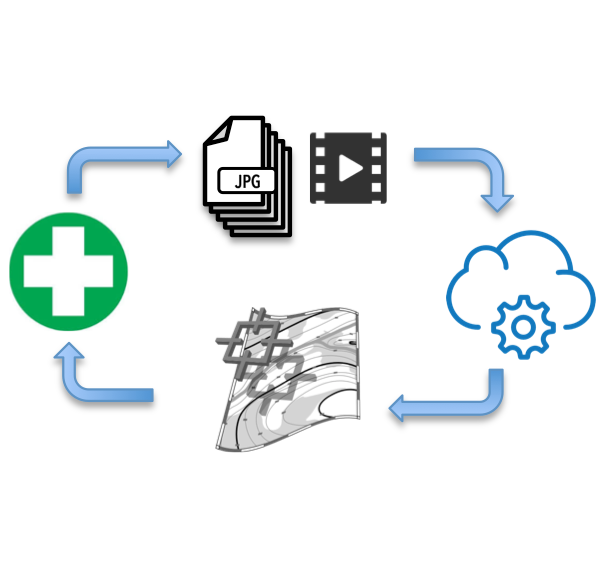
The Lean Process for drone data flow
Posted by: Digital VistaIf you've used Dropbox, you know how to use DigitalVista. You sync your folder of images and video, and within a few minutes to a few hours you'll get an alert that your processing is complete, and the results are already syncing to your devices. It's that simple.
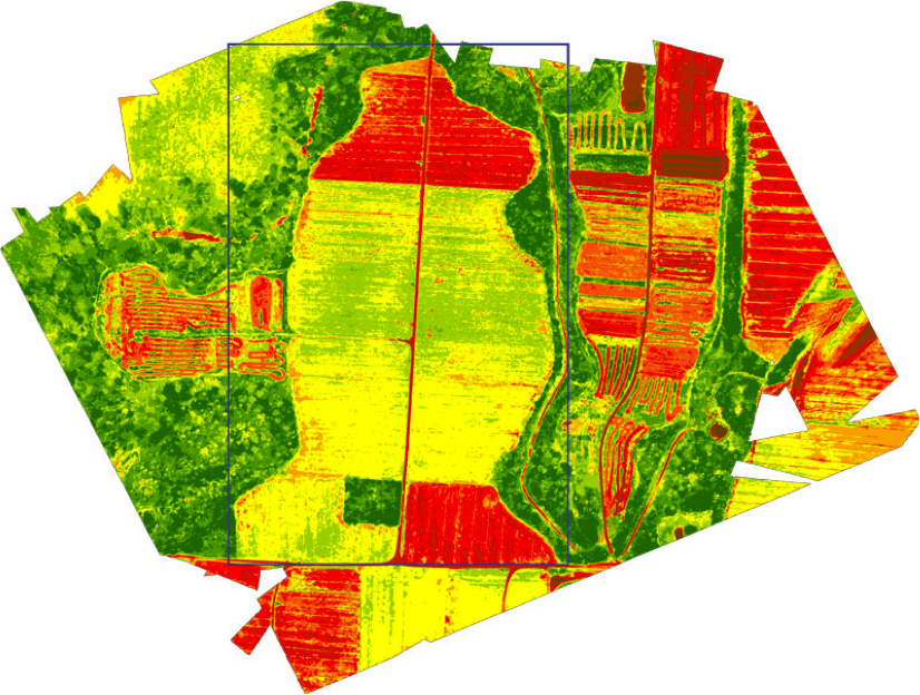
Measuring debris pile volumes from drone collections
Posted by: Digital VistaUpload your drone footage or still images and receive a geo-registered image on a web map that can be integreated into other applications. Get a 3D model that can be used to measure slopes, debris volume, water volume, water, vegetation, and road surface data layers for your GIS.
Mission focused outputs from Digital Vista
Posted by: Digital VistaObject recognition using state of the art deep learning methods to find objects from your data feed. Save operator time by getting a report of identified objects like caved roofs, blue tarps, sinkholes, vehicles, and more. Create a viewshed layer that identifies vantage poitns for spotters or radio repeaters as well as hidden areas that are not easily observable. Publish your data on a private map layer, or open it to the world to receive assistance in mapping an area from the open mapping community.

How to use Digital Vista for mission support
Posted by: AdminWe handle processing your drone data collection into usable information quickly and on demand, 24/7. Our service is specifically tailored to the needs of first responders, law enforcement, search and rescue, and disaster response.